
Geocoder (Beta) allows you to upload a list of addresses and turn them into annotation points on our maps. (Just like our regular annotations, but in bulk.)
Get started with the Geocoder by navigating to the map menu on the right corner (see blue arrow).
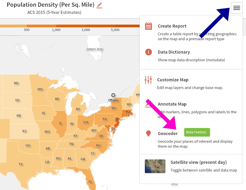
And then click on the Geocoder from the list of options (see pink arrow).
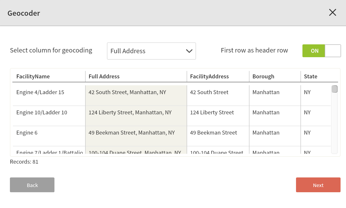
You will then be prompted to upload your data. Upload a CSV file with location data points to turn them into map annotations. When formatting your list, make sure to put all the address information (such as street address, city, state, zip code, etc.) in a single column for best results.
You may also download a sample dataset to see how you should set up your data or just test it out. In this Beta release, you can bring in your own data of up to a 200 addresses at a time.
For this example, let's map firehouses in Manhattan and the Bronx. After pulling in the data, the Geocoder prompts us to specify which column to map. (In this case it's "Full Address.")
Then the Geocoder will prompt you to specify the style and color of your data marker, as well as any titles you want to display.
We used the fire icon in dark purple and hid titles for this pair of maps, which show population density and median income side-by-side.
You can then modify your points as you would any annotation. (Click here for more on annotations.)
