
Census geography is organized on a number of different levels. Some of the levels fit completely within one another, while others may cross the boundary of a larger level.
The basic hierarchical organization of census geography is Nation > States > Counties > County Sub-Divisions > Census Tracts > Block Groups > Blocks, with each level nested completely within its predecessor.
These levels cover all areas in the United States, and added up, their populations equal the entire population of the United States. Other levels, such as places, can cross the boundaries of other levels, and some, such as ZIP codes, do not cover all areas of the United States. ZIP codes only cover those where mail is delivered.
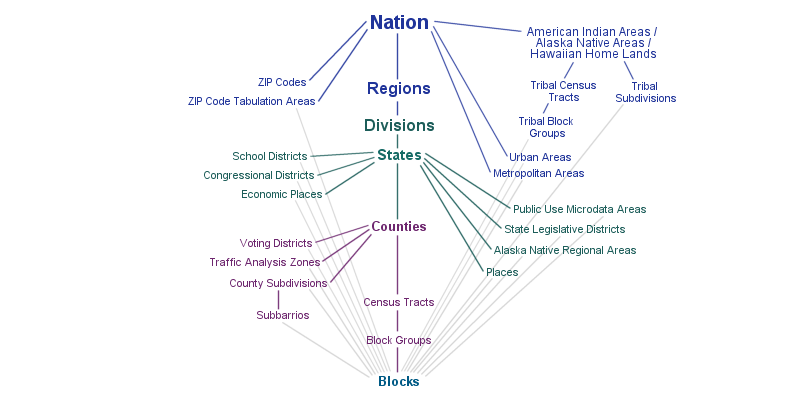
The diagram above shows the relationships between different levels of census geographies. A line between two levels represents a hierarchical relationship between them, meaning that the larger, generally displayed near the top of the diagram, can be subdivided into the smaller level.
